Water supply
Geologically, Stapleford can be divided into three distinct areas. The first comprises the high ground to the south-east of the Nottingham and Derby Road and to the north-east of Ilkeston Road, where the bedrock consists of the Lenton Sandstone Group, formerly known as the Bunter Sandstone. The second area, lying to the west, is the flat alluvial land of the Erewash Valley. The third area, occupying the remaining part of the parish between the Erewash and the high ground, is underlain by the Lower Coal Measures. Wells sunk into the sandstone yield water of satisfactory quality, whereas those drawing from the coal measures or the alluvial plain provide water of inferior quality.
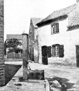
Before the introduction of piped water, people depended either on private wells or on a communal well or pump. The parish pump stood on Nottingham Road at the junction with Church Walk. When the newly formed Parish Council met in 1895 one of its first tasks was to compile a list of parish property on which the parish pump was included.[1]. However, by that time, the pump was no longer in use, having run dry.
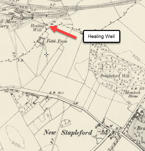
Another water source listed was the ‘Healing Well’ used by the people of New Stapleford and situated near Fields Farm, close to the Trowell border. The name was frequently misrecorded by clerks unfamiliar with its etymology, and in this instance, it is recorded as the ‘Ealey Well.’[2] Investigation revealed that the well lay on the far side of the Trowell Sick Dyke, placing it within the parish of Trowell and, therefore, outside the purview of Stapleford Parish Council, even though it was used by Stapleford people.
Piped water
In 1877, concerns about public health in Stapleford had become so acute that the Local Government Board sent its own inspector, Dr. Richard Thorne, to report on the health of Stapleford. Thorne, an eminent physician who became the Board’s principal medical officer, produced a damning report. He observed that ‘throughout the greater part of Stapleford the water is obviously foul, or is subject to the constant risk of pollution.” Amongst his many recommendations was the provision of an ample and wholesome water supply for the entire village.
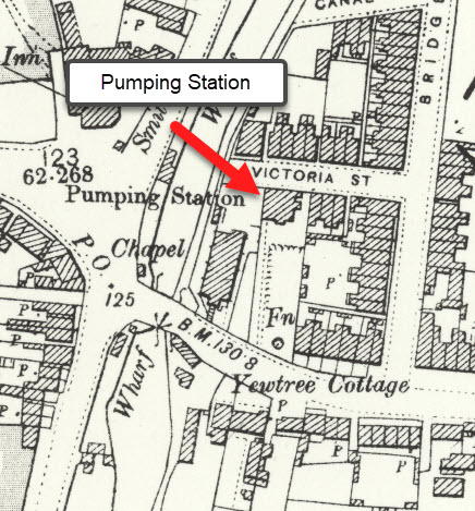
The search for a reliable water supply began in the hamlet of Wilshorpe, between Sandiacre and Long Eaton, in June 1889. However, the attempt was abandoned at a depth 371 feet due to the excessive hardness of the water. Further borings were undertaken, and an abundant supply was eventually discovered on Derby Road, Sandiacre, adjacent to the Methodist chapel. Water was pumped at a rate of 240,000 gallons per day without any diminution, and a water works was established on the site.[3]
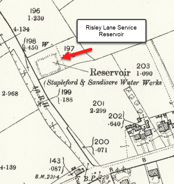
A service reservoir with a capacity of 70,000 gallons was constructed on Rushy Lane at an elevation of 253 feet above sea level and 11 1/2 miles of main laid to distribute the supply. The reservoir’s height provided sufficient pressure for most of Stapleford, with the exception of the farm at the top of Toton Lane, which stood a few feet higher. To overcome this, the farm installed its own windmill to lift water from a pond at the junction of what is now Cliffe Hill Avenue and Windsor Street, with pipes running beneath what would later become the gardens of houses on Toton Lane.